





 asdar.id menyediakan Member Premium Download untuk download file tanpa embel-embel iklan dan halaman, apa lagi harus menunggu timer yang begitu lama. Dengan berlangganan Member Premium Download, semua file dapat didownload dengan singkat langsung menuju ke sumbernya!, klik DISINI untuk DAFTAR atau DISINI untuk LOGIN :-) Jika ada pertanyaan silahkan hubungi Admin DISINI. Untuk cara download file Member Free Download, bisa membaca Tutorial Download yang ada dibawah Timer (halaman Safelink) saat menekan tombol download.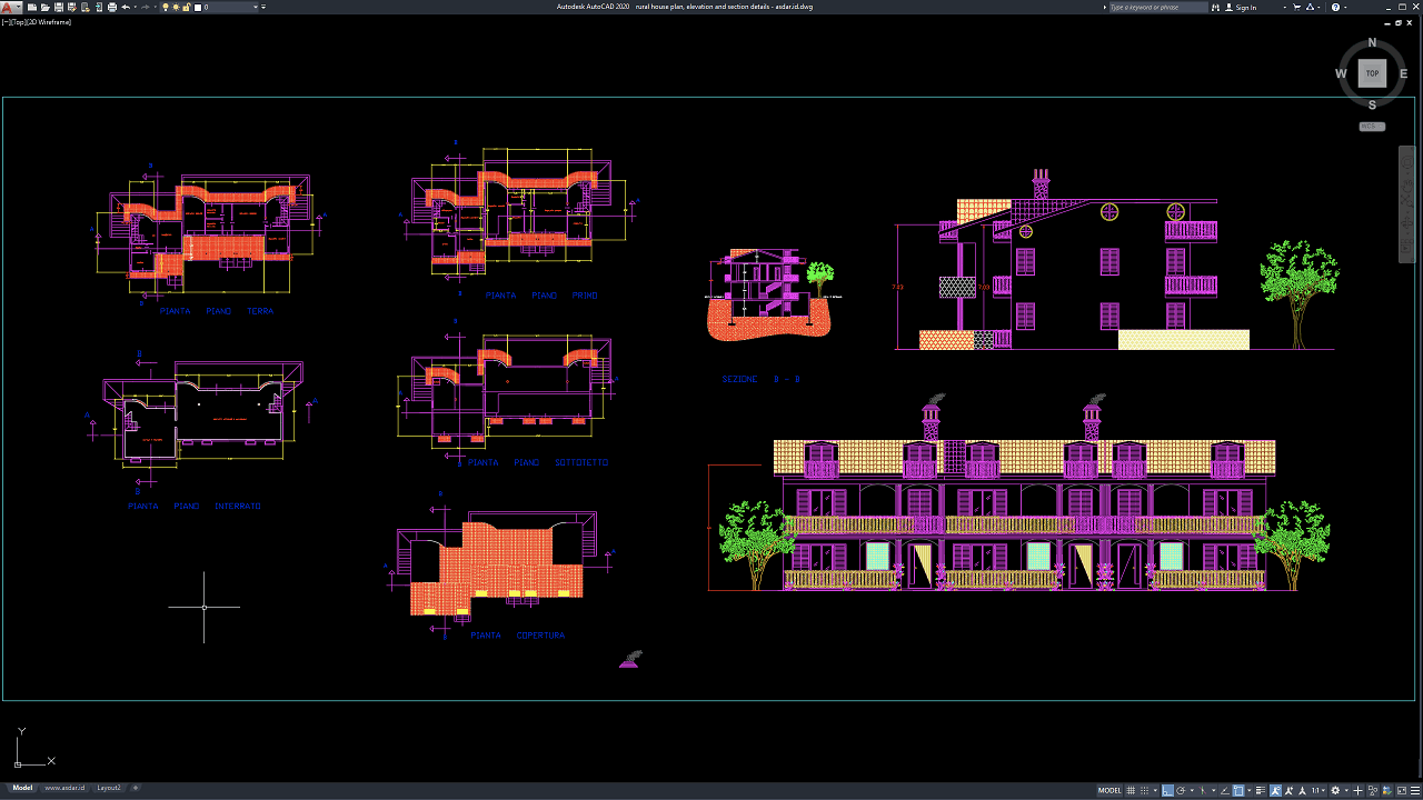
A well-prepared Rural House Plan, Elevation and Section Details DWG AutoCAD drawing can serve as a valuable reference for architects, civil engineers, contractors, CAD technicians, students, and homeowners involved in residential building design. Architectural drawings that combine floor plans, elevations, and sections provide a clearer understanding of the house layout, appearance, dimensions, and construction relationships.
Rural house designs often have different spatial requirements from urban residences. They may prioritize functional living areas, natural ventilation, outdoor spaces, simple circulation, and practical construction methods. A complete architectural drawing package helps translate these requirements into an organized residential design.
Definition of Rural House
A rural house is a residential building located in a rural area, typically surrounded by natural landscapes, agricultural land, villages, or open spaces away from densely populated urban centers. Rural houses are generally designed to provide comfortable, functional, and practical living spaces while adapting to the local environment, climate, available materials, and lifestyle of the residents.
Rural houses can vary in architectural style, size, and construction methods depending on regional traditions, cultural influences, and the needs of the occupants. They may feature spacious layouts, pitched roofs, natural ventilation, large windows, outdoor terraces, and gardens to create a comfortable living environment that integrates with the surrounding landscape.
In architectural and construction planning, a rural house is designed to balance functionality, structural stability, comfort, and environmental compatibility. Its layout typically includes essential residential spaces such as bedrooms, living rooms, kitchens, bathrooms, and service areas, with the possibility of additional spaces such as storage rooms, balconies, or outdoor living areas.
Why Rural House Plan, Elevation and Section Details Are Important
Using only one type of architectural view can make it difficult to understand the complete building. A floor plan explains the horizontal arrangement, an elevation describes the exterior appearance, and a section explains the vertical construction relationship.
Together, these drawings provide a more comprehensive representation of the proposed house. Architects can use them to develop the architectural concept, while contractors and CAD technicians can use them as references when preparing construction documentation.
For students and architecture learners, these drawings can also be useful for studying residential planning, architectural drafting, building proportions, and the relationship between plan, elevation, and section views.
Download Rural House Plan, Elevation and Section Details DWG AutoCAD
Proper Rural House Plan, Elevation and Section Details DWG AutoCAD drawings are valuable architectural references for understanding the spatial arrangement, building levels, exterior appearance, roof configuration, dimensions, and vertical relationships of a rural residential building. These drawings are particularly useful for architects, civil engineers, contractors, CAD technicians, BIM coordinators, students, and construction professionals involved in residential design and documentation.
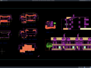
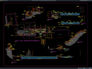
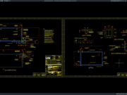
As shown in the drawing, the CAD sheet presents a comprehensive rural house architectural layout, including several floor plans, roof plan, building elevations, and section views. The drawing includes plans identified as ground floor, first floor, basement, attic, and roof, providing an overview of the different levels and their relationship within the house. The sheet also includes detailed exterior elevations and sectional views of the residential building.
The main rural house floor plans illustrate the arrangement of rooms, internal circulation, entrances, stairways, walls, openings, and other architectural elements on different levels. The presence of separate plans for the ground floor, first floor, basement, and attic allows the overall organization of the multi-level residence to be studied from different horizontal views. Dimensions and reference lines around the plans provide additional information for understanding the building layout.
The drawing also includes a roof plan, showing the configuration and coverage of the roof over the residential building. The roof layout helps clarify the relationship between the main building footprint, roof edges, sloped roof areas, and vertical elements such as chimneys. This information is useful when coordinating the architectural roof design with the floor plans and building elevations.
Several section views are presented to illustrate the vertical configuration of the rural house. These sections show multiple building levels, floor-to-floor relationships, staircases, roof structures, wall arrangements, and the connection between the building and the surrounding ground. The sectional views provide information that cannot be fully understood from the floor plans alone.
The exterior elevation drawings provide a clear representation of the architectural character of the house. The elevations show multiple windows, doors, balconies or veranda areas, roof forms, chimneys, facade elements, exterior railings, and surrounding landscaping. The front elevation particularly illustrates the long residential facade with repeated openings, balcony areas, roof elements, and trees positioned around the building.
The drawing also demonstrates how doors, windows, balconies, stairs, and exterior architectural elements are coordinated across the different views. Comparing the plans with the elevations and sections helps designers understand how individual architectural components are positioned horizontally and vertically throughout the building.
Incomplete or inaccurate Rural House Plan, Elevation and Section Details may result in inconsistent room layouts, incorrect dimensions, conflicts between floor levels, unsuitable stair configurations, roof coordination problems, or discrepancies between the architectural plans and elevations. Proper coordination between architects, engineers, contractors, CAD technicians, and other construction professionals is therefore important when developing residential building documentation.
Detailed AutoCAD DWG files allow architects and CAD technicians to review and adapt floor layouts, building elevations, section views, roof arrangements, openings, balconies, staircases, dimensions, and other architectural elements according to specific project requirements and applicable building standards. The drawing shown provides a practical reference for rural house planning, residential floor plans, house elevation design, building section details, multi-level house layouts, roof plans, architectural drafting, residential construction, and construction documentation.
For those of you who prefer a simpler and faster download experience on asdar.id, I also provide a Premium Member Download service that allows direct access to the original file. This way, you will not be disturbed by excessive advertisements or multiple redirect pages during the download process. If you are interested, please register HERE. Please download the Rural House Plan, Elevation and Section Details DWG AutoCAD file below:
Rural House Plan, Elevation and Section Details DWG AutoCAD
| Google Drive | DOWNLOAD[1.22MB] |
| Mediafire | DOWNLOAD[1.22MB] |
Rar password: www.asdar.id
Important Note: If you encounter a problem where the WinRAR file cannot be extracted or appears corrupted, the solution is to update the WinRAR application on your computer to the latest version. Download the latest version of WinRAR here.
If you would like to copy this article, please include the original source because I have seen some blogs repost the content without providing proper credit. Otherwise, please rewrite it using your own words. Respect and appreciate the work and effort of others.
The Rural House Plan, Elevation and Section Details DWG AutoCAD provides a useful architectural reference for understanding the relationship between residential floor plans, exterior elevations, and building sections. These complementary views make it easier to study room arrangements, building proportions, exterior appearance, and vertical construction relationships.
For architects, engineers, contractors, CAD technicians, students, and residential designers, an editable DWG drawing can support architectural drafting, design development, project coordination, and construction documentation. With appropriate modifications and professional verification, the drawing can serve as a useful reference for developing rural and countryside residential projects.