





 asdar.id menyediakan Member Premium Download untuk download file tanpa embel-embel iklan dan halaman, apa lagi harus menunggu timer yang begitu lama. Dengan berlangganan Member Premium Download, semua file dapat didownload dengan singkat langsung menuju ke sumbernya!, klik DISINI untuk DAFTAR atau DISINI untuk LOGIN :-) Jika ada pertanyaan silahkan hubungi Admin DISINI. Untuk cara download file Member Free Download, bisa membaca Tutorial Download yang ada dibawah Timer (halaman Safelink) saat menekan tombol download.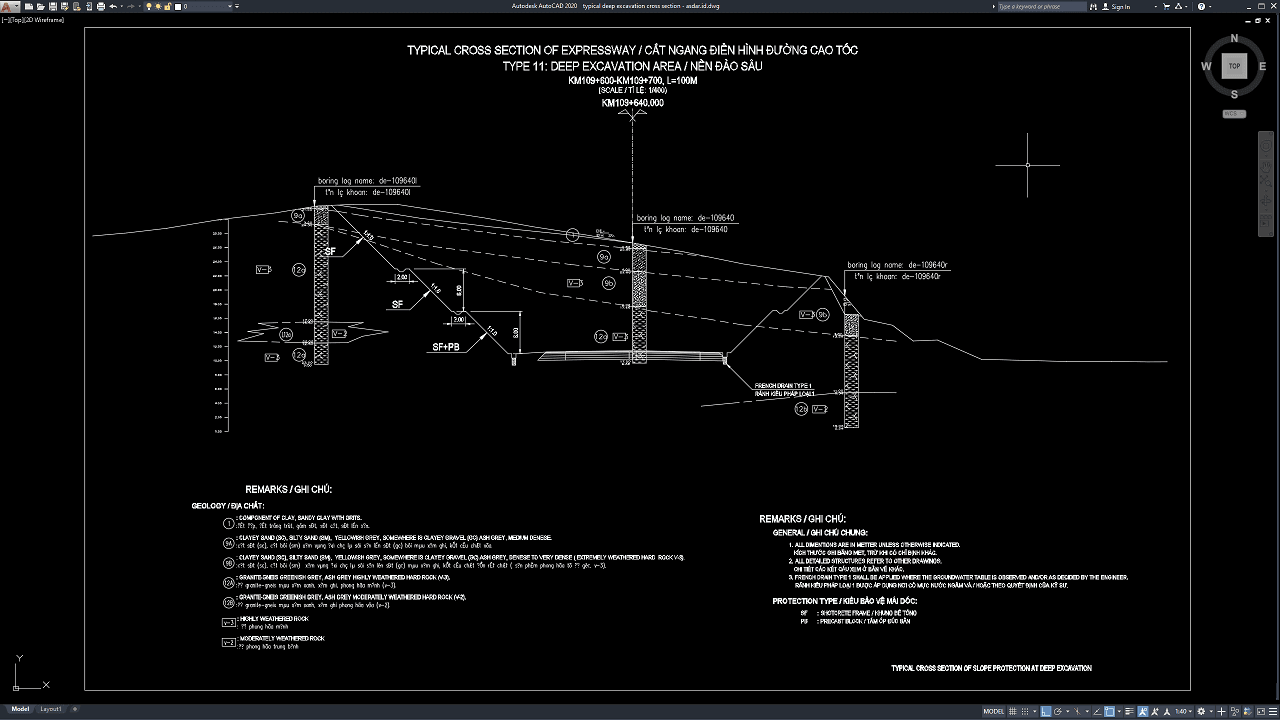
Deep excavation is an important part of major civil engineering and infrastructure projects, especially where roads, basements, retaining structures, bridge foundations, drainage systems, utilities, and underground facilities must be constructed below the existing ground level. Because excavation changes the natural support of soil and rock, proper cross-section drawings are essential for understanding excavation geometry, slope protection, drainage, retaining systems, and construction stages.
In this article, we share a reference for Typical Deep Excavation Cross Section DWG AutoCAD that can be useful for civil engineers, geotechnical engineers, structural engineers, contractors, surveyors, CAD technicians, quantity surveyors, students, and construction professionals. The drawing can provide a practical reference for excavation slopes, benches, protection systems, retaining elements, drainage arrangements, and construction documentation.
What Is a Deep Excavation?
A deep excavation is an excavation that extends significantly below the existing ground surface and requires careful engineering assessment to maintain stability during construction. Deep excavations may be required for basements, underground parking facilities, transportation infrastructure, retaining walls, bridge structures, tunnels, utilities, and road construction.
The exact depth at which an excavation is considered “deep” depends on the project, soil conditions, nearby structures, groundwater, and construction method.
Unlike shallow earthwork, deep excavation can involve significant soil pressure, groundwater pressure, ground deformation, and temporary stability concerns.
For this reason, the excavation system should be designed according to site-specific geotechnical and structural conditions.
Importance of Deep Excavation Cross Sections
Plans show the excavation from above, but cross sections explain how the excavation develops vertically.
A detailed Typical Deep Excavation Cross Section DWG AutoCAD drawing can help project teams identify excavation depths, slope angles, bench positions, stabilization systems, and changes in elevation.
Without accurate section drawings, contractors may excavate incorrect slopes, install protection systems at the wrong level, or create unsuitable bench dimensions.
These errors can lead to additional earthwork, redesign, slope instability, construction delays, and increased project costs.
Download Typical Deep Excavation Cross Section DWG AutoCAD
Proper Typical Deep Excavation Cross Section DWG AutoCAD drawings are essential for accurately coordinating excavation geometry, slope gradients, bench levels, geological conditions, protection systems, drainage elements, and roadway interfaces in highway and civil infrastructure projects. Civil engineers, geotechnical engineers, structural engineers, contractors, and site supervisors must carefully coordinate excavation depths, slope ratios, bench widths, soil and rock layers, groundwater conditions, and stabilization systems to achieve a safe and stable deep excavation profile.
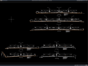
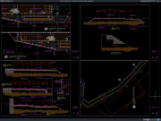
Detailed drawings such as deep excavation cross sections, slope profiles, bench arrangements, geological borehole information, shotcrete frame protection, precast block protection, drainage details, and dimensional references help engineering and construction teams understand the complete excavation configuration before earthwork and stabilization begin. As shown in the drawing, the CAD layout presents a typical expressway deep excavation cross section around KM109+600 to KM109+700, including staged slope faces with approximately 1:1.0 gradients, bench widths, borehole logs, geological layer references, protection zones marked SF and SF+PB, and a French drain Type 1 at the lower excavation level.
Incomplete or inaccurate Typical Deep Excavation Cross Sections may result in incorrect excavation depths, unstable slope faces, poorly positioned benches, insufficient protection systems, drainage problems, and construction difficulties. Accurate geotechnical and civil engineering drawings and proper coordination between engineers, contractors, surveyors, and site teams are therefore important for achieving safe, controlled, and reliable deep excavation works.
Detailed AutoCAD DWG files also allow engineers and designers to review and modify excavation profiles, slope gradients, bench dimensions, protection zones, geological references, drainage locations, and other construction details according to specific project requirements and applicable engineering standards. The drawing shown provides a practical reference for deep excavation engineering, expressway slope design, geotechnical cross sections, shotcrete and precast block protection, drainage coordination, and civil construction documentation.
For those of you who prefer a simpler and faster download experience on asdar.id, I also provide a Premium Member Download service that allows direct access to the original file. This way, you will not be disturbed by excessive advertisements or multiple redirect pages during the download process. If you are interested, please register HERE. Please download the Typical Deep Excavation Cross Section DWG AutoCAD file below:
Typical Deep Excavation Cross Section DWG AutoCAD
| Google Drive | DOWNLOAD[375.48KB] |
| Mediafire | DOWNLOAD[375.48KB] |
Rar password: www.asdar.id
Important Note: If you encounter a problem where the WinRAR file cannot be extracted or appears corrupted, the solution is to update the WinRAR application on your computer to the latest version. Download the latest version of WinRAR here.
If you would like to copy this article, please include the original source because I have seen some blogs repost the content without providing proper credit. Otherwise, please rewrite it using your own words. Respect and appreciate the work and effort of others.
Typical Deep Excavation Cross Section DWG AutoCAD drawings provide useful technical references for understanding excavation depths, slope geometry, benches, protection systems, drainage, retaining structures, and construction sequencing.
Accurate CAD documentation can improve coordination between geotechnical engineers, civil engineers, structural engineers, surveyors, contractors, quantity surveyors, and project managers while supporting safer excavation design, more reliable cost estimation, efficient construction planning, and better long-term project performance.