





 asdar.id menyediakan Member Premium Download untuk download file tanpa embel-embel iklan dan halaman, apa lagi harus menunggu timer yang begitu lama. Dengan berlangganan Member Premium Download, semua file dapat didownload dengan singkat langsung menuju ke sumbernya!, klik DISINI untuk DAFTAR atau DISINI untuk LOGIN :-) Jika ada pertanyaan silahkan hubungi Admin DISINI. Untuk cara download file Member Free Download, bisa membaca Tutorial Download yang ada dibawah Timer (halaman Safelink) saat menekan tombol download.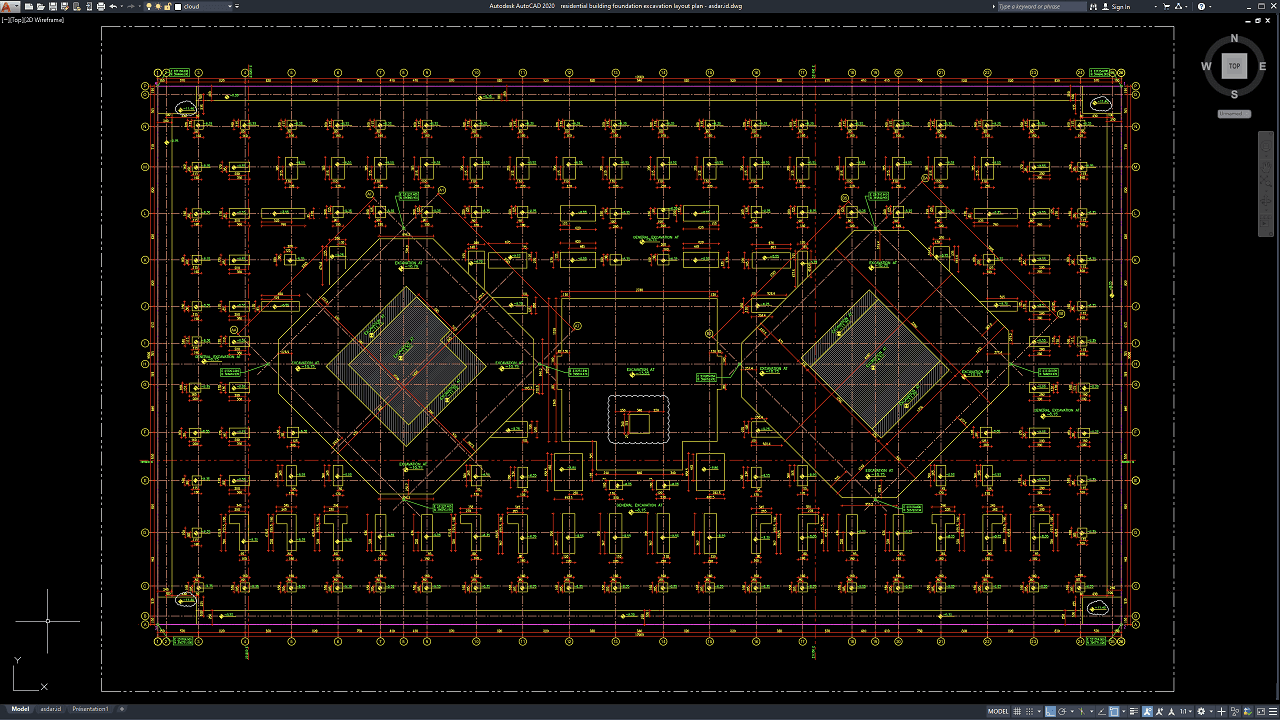
Foundation excavation is one of the earliest and most important stages of residential building construction. Before footings, columns, grade beams, retaining walls, or ground-floor structural elements can be installed, the excavation must be set out accurately according to the approved structural and architectural drawings. Errors during excavation can affect foundation position, building alignment, structural stability, construction cost, and the overall progress of the project.
In this article, we share a reference for Residential Building Foundation Excavation Layout Plan DWG AutoCAD that can be useful for civil engineers, structural engineers, architects, geotechnical engineers, contractors, quantity surveyors, surveyors, construction managers, BIM coordinators, CAD technicians, site engineers, estimators, and civil engineering students.
The drawing can provide a practical reference for residential foundation design, excavation planning, structural engineering services, geotechnical engineering, construction cost estimation, earthwork quantity takeoff, BIM coordination, site preparation, foundation construction, and residential project management.
What Is a Foundation Excavation Layout Plan?
A foundation excavation layout plan is a technical drawing that shows the position, dimensions, alignment, and extent of excavation required for foundations beneath a building.
The drawing may indicate structural grid lines, footing locations, excavation boundaries, foundation trenches, column positions, grade beams, foundation depths, dimensions, level references, and setting-out information.
For residential projects, the excavation layout is normally prepared after the architectural and structural designs have been coordinated.
It provides contractors and surveyors with the information needed to transfer the foundation design accurately from the drawing to the construction site.
What Is Foundation Excavation?
Foundation excavation is the process of removing soil to the required depth and dimensions so that structural foundations can be constructed.
Depending on the building and soil conditions, excavation may be required for isolated footings, strip footings, combined footings, raft foundations, pile caps, retaining walls, ground beams, or basement structures.
The excavation should expose stable ground suitable for supporting the foundation system.
If unsuitable soil is encountered, additional excavation, soil replacement, ground improvement, or foundation redesign may be required.
Importance of Foundation Excavation Drawings
Accurate Residential Building Foundation Excavation Layout Plan DWG AutoCAD drawings help ensure that foundations are constructed in the correct positions.
Incorrect excavation can lead to misplaced footings, insufficient working space, excessive earthwork, conflicts with underground utilities, and problems with structural alignment.
Over-excavation can increase concrete and backfill costs. Under-excavation can create insufficient foundation depth or dimensions.
Clear CAD drawings reduce these risks by providing accurate dimensional and setting-out information.
Download Residential Building Foundation Excavation Layout Plan DWG AutoCAD
Proper Residential Building Foundation Excavation Layout Plan DWG AutoCAD drawings are essential for accurately coordinating foundation excavation limits, structural grid lines, footing positions, column locations, excavation dimensions, setting-out references, and surrounding foundation zones within residential construction projects. Structural engineers, civil engineers, geotechnical consultants, surveyors, contractors, quantity surveyors, BIM coordinators, and CAD technicians must carefully coordinate excavation geometry, foundation locations, grid intersections, dimensional references, and structural alignments to ensure that the building foundations are positioned correctly before concrete and reinforcement work begins.
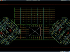
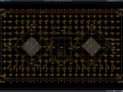
Detailed drawings such as foundation excavation plans, footing layouts, structural grid plans, excavation boundaries, setting-out dimensions, column locations, foundation pit details, and level references help construction teams understand how excavation work should be distributed across the building footprint. As shown in the drawing, the CAD sheet presents a large rectangular foundation layout organized by an extensive structural grid, with numerous repeated excavation and footing positions arranged around the perimeter and internal zones. Two prominent diagonally oriented excavation areas are visible within the central-left and central-right portions of the plan, together with many smaller rectangular foundation locations, dimension chains, grid references, and excavation annotations distributed throughout the residential building footprint.
Incorrect or incomplete Residential Building Foundation Excavation Layout Plan drawings may result in misplaced footings, inaccurate excavation sizes, incorrect column alignment, excessive earthwork, insufficient working space, conflicts between adjacent foundation elements, and costly corrections before structural construction begins. Accurate structural and excavation documentation, together with proper coordination between structural engineers, geotechnical engineers, surveyors, contractors, quantity surveyors, BIM coordinators, and site teams, is therefore important for ensuring that every foundation excavation is constructed at the correct position, size, and alignment.
Detailed AutoCAD DWG files also allow engineers and contractors to review and modify excavation boundaries, footing locations, structural grid lines, foundation dimensions, setting-out references, and individual excavation zones according to specific project requirements. The drawing shown provides a practical reference for residential foundation excavation planning, footing setting-out, structural grid coordination, foundation pit layout, earthwork quantity takeoff, site surveying, foundation construction planning, and residential structural drafting.
For those of you who prefer a simpler and faster download experience on asdar.id, I also provide a Premium Member Download service that allows direct access to the original file. This way, you will not be disturbed by excessive advertisements or multiple redirect pages during the download process. If you are interested, please register HERE. Please download the Residential Building Foundation Excavation Layout Plan DWG AutoCAD file below:
Residential Building Foundation Excavation Layout Plan DWG AutoCAD
| Google Drive | DOWNLOAD[410.70KB] |
| Mediafire | DOWNLOAD[410.70KB] |
Rar password: www.asdar.id
Important Note: If you encounter a problem where the WinRAR file cannot be extracted or appears corrupted, the solution is to update the WinRAR application on your computer to the latest version. Download the latest version of WinRAR here.
If you would like to copy this article, please include the original source because I have seen some blogs repost the content without providing proper credit. Otherwise, please rewrite it using your own words. Respect and appreciate the work and effort of others.
Residential Building Foundation Excavation Layout Plan DWG AutoCAD drawings provide valuable technical references for understanding how structural grids, footing locations, excavation boundaries, ground beams, foundation trenches, and construction levels are coordinated before residential foundations are built.
Accurate CAD documentation can improve coordination between structural engineers, geotechnical consultants, surveyors, contractors, BIM coordinators, quantity surveyors, and construction managers. It can also support more reliable foundation excavation cost estimation, earthwork quantity takeoff, structural setting-out, BIM clash detection, foundation construction planning, site grading, project scheduling, and construction cost control.
Successful residential foundation construction begins with accurate excavation. Correct setting-out, suitable soil conditions, proper depth, groundwater control, safe excavation practices, and clear structural documentation all contribute to reliable long-term performance. When excavation planning, structural engineering, geotechnical analysis, surveying, and construction management are properly coordinated, the foundation can provide a stable and durable base for the entire residential building.